
North. Safe. Sound.
Built for Northern Conditions
SmartICE technology has been developed specifically for Arctic environments. Designed to withstand arctic winter conditions, the sensors operate in remote regions where reliable ice information is critical for ice travel, cultural activities, emergency prevention, and search-and-rescue response.
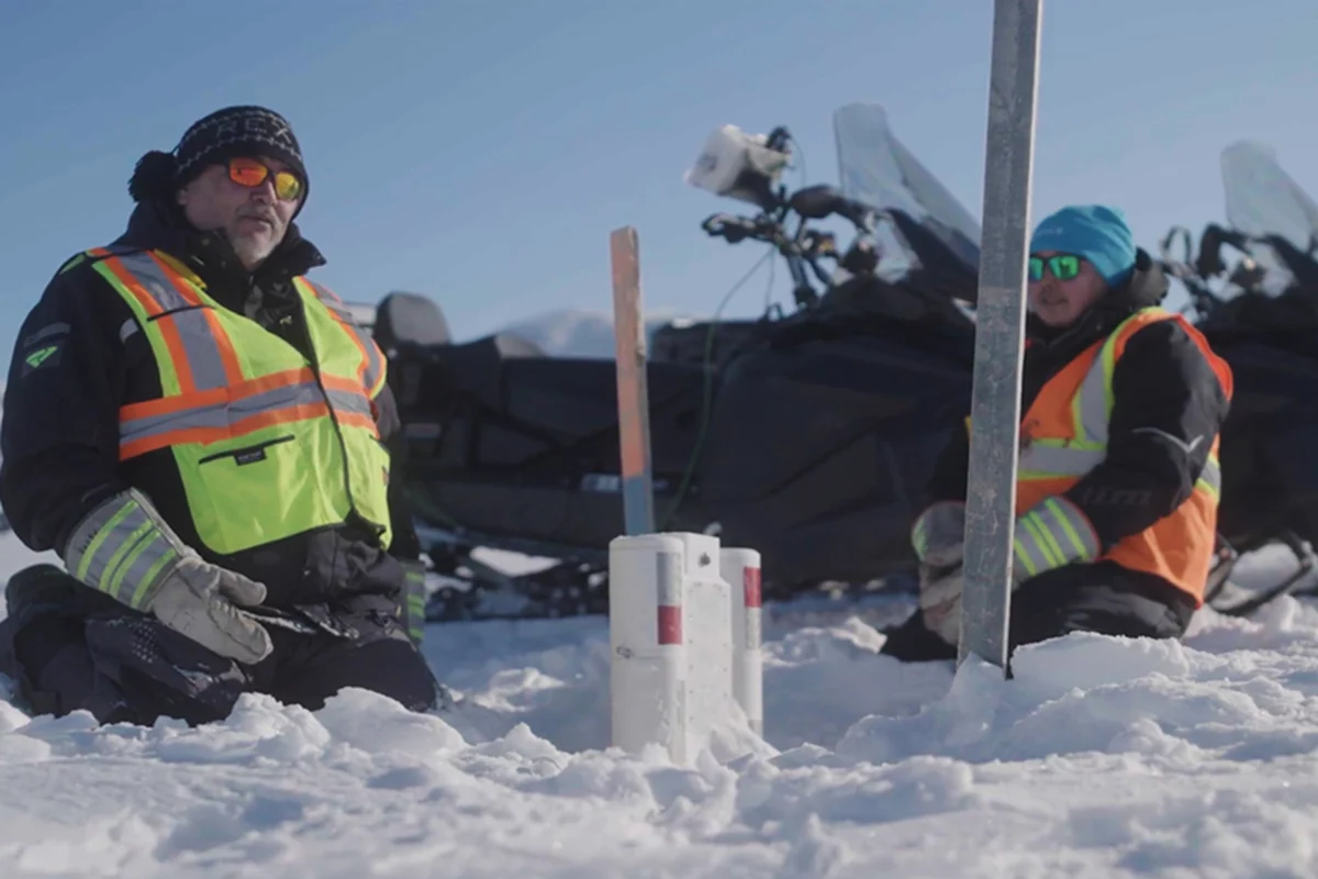
Fixed Monitoring
SmartBUOYs are ice monitoring sensors deployed in the ice to measure ice thickness using thermistors, which operate like thermometers. Each SmartBUOY contains 60 thermistors that measure the temperature of the air, snow, ice and water. This temperature profile helps determine ice thickness.
SmartBUOYs monitor both sea ice and freshwater ice. In sea ice environments, they are deployed in landfast ice. In freshwater environments, they provide information about lake and river ice conditions in areas used by communities for travel, harvesting and other activities.
Data are transmitted via satellite one to two times per day and shared with communities through SIKU
Mobile Monitoring
SmartICE’s mobile ice monitoring provides information about ice conditions along community trails in both sea ice and freshwater environments.
In sea ice environments, the Ice Profiler (previously known as the SmartQAMUTIK) is towed behind a snowmobile and provides real-time ice thickness measurements as the operator travels. Using electromagnetic signals and the electrical conductivity of seawater, the Ice Profiler measures the distance from the top of the snow to the bottom of the ice. Measurements are displayed to the operator in real time.
In freshwater environments, SmartICE currently uses IceMap™, a mobile ground-penetrating radar (GPR) system to monitor ice thickness.
Monitoring trips are completed at least once per week in each community, and ice thickness information is shared with communities through SIKU.
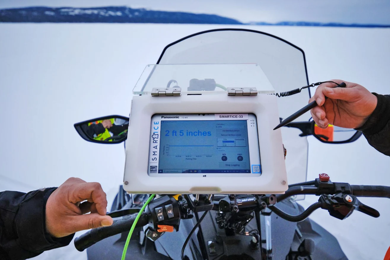
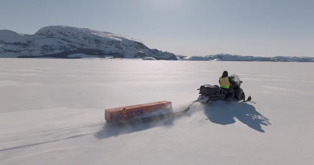
The Ice Profiler measures ice thickness using electromagnetic signals and the salinity of seawater. It transmits electromagnetic signals through the snow and ice, which induce electrical currents in the conductive saltwater below. These signals return to the sensor, producing an instantaneous measurement from the top of the snow to the bottom of the ice.
IceMap™ uses ground-penetrating radar (GPR) to continuously measure and map ice thickness in freshwater environments, helping identify thin or problematic ice along community trails, winter roads, and ice roads.
Monitoring trips are completed at least once per week in each community, and data is shared with communities through SIKU.org.
GIS and
Remote Sensing
SmartICE Knowledge Coordinators are trained in interpreting optical and synthetic aperture radar (SAR) satellite images for their community. They use their expertise to create weekly ice travel safety maps that utilize satellite imagery overlaid with local Indigenous Knowledge, SmartBUOY deployment sites, and ice thickness information from the Ice Profiler.
Monitoring Services for Industry and Research
SmartICE provides ice monitoring solutions for transportation, fisheries, tourism, engineering, and defence and sovereignty operations across the Arctic and other seasonally ice-covered regions. Our technology and accurate ice information reduce delays and fuel costs, improve logistics, and promote informed operational decisions in unpredictable northern environments.
Recent and ongoing projects highlight the diverse applications of SmartICE services:
- Since 2024, SmartICE has partnered with the Department of Labrador Affairs to support the planning, monitoring, and maintenance of the Labrador Winter Trails network. These trails are critical transportation links for northern communities in Labrador, enabling access to hunting grounds, neighbouring communities, and essential services.
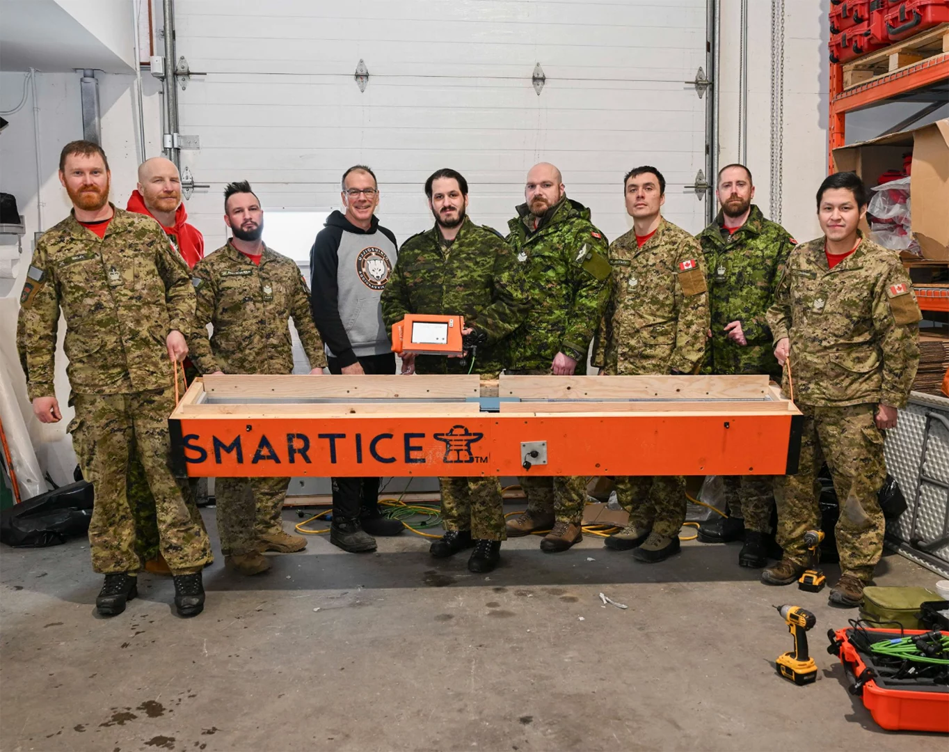
- In spring 2026, SmartICE provided ice monitoring equipment, training, and technical support to the 1 Canadian Ranger Patrol Group to facilitate the safe movement of personnel and equipment along a portion of the Northwest Passage between Kugluktuk, NU, and Churchill, MB. This support contributed to a historic 5,200-kilometre, 52-day patrol involving approximately 200 Rangers, helping manage the logistical challenges of Arctic travel while supporting Canada‘s renewed focus on Arctic sovereignty.
Connected to local ice conditions.
Access SmartICE monitoring data, ice thickness information, and Ice Safety Maps through SIKU. Browse the Quick Guide to SmartICE on SIKU below for detailed instructions and learn how to access local ice information.

Download our quick guide to get started.
Faq
How does SmartICE incorporate Indigenous knowledge with the technology?
SmartICE was founded on the principle that technology should augment, not replace, Indigenous and local knowledge of safe ice travel. Indigenous knowledge holders and experienced local travellers understand the land, ice, weather, and changing conditions in their communities in ways that technology cannot replicate.
SmartICE’s monitoring technologies provide additional, near-real-time information about ice conditions, such as ice thickness measurements, that can be considered alongside this knowledge. Together, these sources of information help community members make more informed decisions about when and where to travel on the ice.
Indigenous and local knowledge remains at the centre of decision-making. SmartICE technology is another tool communities can use to complement the knowledge, experience, and observations that guide safe ice travel.
Who decides where the SmartICE technology will be deployed?
Communities decide where SmartICE technology is deployed. SmartICE works with a local governance structure or a Community Management Committee (CMC) in each serviced community to ensure monitoring responds to local priorities and needs.
CMCs bring together local knowledge and perspectives, including Elders, youth, and representatives from organizations such as Hunters and Trappers Associations and municipal governments. The committee helps determine where monitoring technology should be deployed, how SmartICE operates in the community, and how its services can best support local ice travel.
Where a CMC is not established, SmartICE works directly with the local governance structure or a trusted community partner to determine monitoring priorities and where technology will be most useful. This could include the local Hunter’s and Trapper’s Organization/Association or Hamlet.
This community-led approach ensures that SmartICE technology is deployed where it is most relevant and useful for ice travellers.
Who operates and deploys the technology?
SmartICE technology is operated and deployed by trained local community members. During the ice season, community members are hired as SmartICE operators and complete comprehensive training to operate, deploy, and maintain the technology and collect ice monitoring data.
This community-based approach ensures that monitoring is carried out by people with local knowledge and experience of the ice and conditions in their community.
Where can I find the ice thickness information?
SmartICE is partnered with SIKU to share data from its ice-monitoring technologies. SIKU is an Indigenous knowledge social network platform.
Through SIKU, users can access SmartICE ice thickness data to help inform their travel decisions. Users can also contribute their own ice observations by sharing posts to their community's feed that include photos, Indigenous knowledge, and information about current ice conditions and formations.
Does SmartICE technology operate in both sea-ice and freshwater environments?
Yes. SmartICE technology is designed to monitor ice conditions in both sea-ice and freshwater environments, including lakes and rivers.
How is SmartICE data communicated to communities?
Data from SmartICE technologies is shared with communities through multiple channels, including the SIKU platform, social media, local radio, and printed materials.
SmartICE also provides communities with a weekly Ice Thickness Report (ITR). The report can be shared digitally on social media or printed and distributed in community locations such as post offices, community halls, and other public spaces.